drumming katydid
Meconema thalassinum
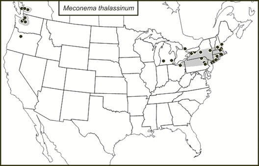
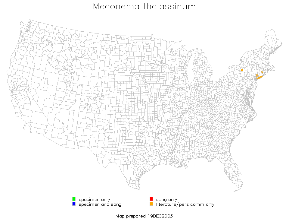
In emails of 24and 25 Oct 2017, David J. Ferguson alerted me to the fact that BugGuide had images of a Meconema with very short wings that had been photographed in the Seattle area of Washington and in New York, New York. OSFO recognizes only two species of Meconema: M. thalassinum and M. meridionale. The former occurs in northern Europe and the latter in southern Europe. This suggests possible sympatry or parapatry in northern Spain, Italy, and the Balkan Peninsula. On the basis of short-winged Meoconema in Europe being recognized as a species distinct from M. thalassinum, BugGuide photographs of short-winged Meconema are assigned to the species M. meridionale.
As Ferguson recognized, this placement is questionable because the short-winged North American Meconema seem to have appeared simultaneously in two U.S. areas where M. thalassinum had long ago become abundant. Genetic analysis of the two morphs in these two areas should quickly show whether two species names for North American Meconema are justified. Whether they are justified or not, genetic comparisons with European Meconema should be of interest.
T.J. Walker
October 2017